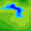
I've always thought it'd be cool to create a map of the Avatar: The Last Airbender world like the kind of composite satellite image you see on Google Maps. I started this project a while ago then stopped, and I only recently started back up again. It is far from complete
Most of it was made by taking chunks of real Earth and pasting them onto the Avatar map, then editing them around to look nice. Recently, I've been trying out drawing it from scratch. The peninsula at the south coast of Chameleon Bay was made entirely from scratch (still working on it). Ba Sing Se was made mostly from scratch as well (still looks weird). The poles were made by drawing on pictures of Antarctica. I think they turned out quite nicely. The Shi Wong Desert is the Sahara and I can't remember where the northwestern Earth Kingdom came from. Perhaps western Canada or Europe.
Full size image: http://image.wikifou...deb434d851a0e50
I can't seem to get it to post right and Imgur is broken for me, so I just gave you the link instead. Sorry.


